Bam is located on the southern edge of the Iranian plateau, in a desert environment.
The creation and growth of the city was based on the underground irrigation canals, the qanāts of which Bam has preserved some of the earliest evidence in Iran. The archaeological discoveries of ancient qanāts in the south-eastern suburbs of Bam are datable to the beginning of the 2nd century BC.
|
|
 Fig. 1 – Arg-e-Bam before the earthquake (Source: ICHO)  Fig. 2 – Arg-e-Bam after the earthquake |
When properly utilized, earth is no more inferior to any other building material.
A brief history of Arg-e-Bam
There is no precise archaeological dating of the buildings of the Citadel of Bam. But through historic sources and ancient texts, the first human settlement in the area can be traced back to the fort built by the Achaemenians around 579-323 BC. Some of the citadel’s features such as its establishment on a platform combining a natural hilltop and a manmade terrace have been compared by archaeologists to the Achaemenian model of Persepolis.
During the Parthian rule, the fort was expanded and became Arg-e-Bam, the Citadel of Bam. A comparative study titled “Bam and a Brief History of Urban Settlement and Planning in Iran” concluded that the essential core of the city of Bam and the Governor’s section were built during the Parthian era.
Under the Sassanids, the castle was seized by Ardeshir Babakan. New fortifications and walls were constructed between 224 and 637 AD.
A few years later, in 645 AD, the Kerman region was conquered by the Arabs and Arg-e-Bam probably suffered damages during the war. One of the Arab commanders established the Al Rasoul mosque, one of the first mosque built in Iran in the early Islamic era.
In 656 AD, the Khavarej, a group of fanatic Moslems defeated by Imam Ali, escaped to Kerman and Bam were they settled in the Arg-e-Bam.
In 869 AD, Yaqoob Laith Saffari who was fighting the Abbasids, defeated the Khavarej and took over the Arg-e-Bam. It then became his permanent base camp.
The name of Bam is mentioned for the first time by Islamic writers in the 10th century. According to these authors, Bam was then a well established market place surrounded by a wide agricultural area. The city was famous for its elegant/tasteful cotton fabrics, its supposedly impregnable fortress, its busy bazaars and its palm trees.
After the Mogul invasion of lran, Bam and the Kerman region were turned over to the Qarakhataian dynasty who ruled the region from 1240 to 1363 AD.
Bam benefited from a strategic location on the spice route connecting the region to the Silk Road. The city was renowned for silkworm breeding and a flourishing silk industry.
During the Safavid rule (from 1502 to 1722), Iran went through a period of relative calm and stability. Arg-e-Bam was considerably developed, as well as the rest of the country. The Four Seasons Palace was built during this period.
Towards the end of the Safavid period, Arg-e-Bam was conquered by the founder of the Qajar Dynasty, Agha Mohammad Khan, who used the citadel as a strategic point to fend off Afghan and Baluchi incursions and thus turned it into a military complex.
In 1839, Agha Khan Mahallati, founder of the Esmaili sect, rose up against Mohammad Shah Qajar and took refuge in Arg-e-Bam, until prince Firooz Mirza who was later to be known as Farman Farma (the Ruler of Rulers) arrested him.
The increasing military presence within the walls of Arg-e-Bam gradually led people to settle outside the limits of the ramparts: in l880 Firooz Mirza wrote that only military personnel were residing within the citadel area and he suggested that the old and abandoned city sitting at the foot of the citadel be demolished and the area turned into a garden.
In 1900, the construction of the new city of Bam began and people progressively left the old Bam.
Arg-e-Bam, the citadel, was used a garrison until 1932 but it seems that no one was living in the old city at the foot of the citadel anymore. Arg-e-Bam and the old city have therefore been totally abandoned since 1932.
In 1953, the site became recognized as a nationally significant historic site and a gradual process of conservation and restoration began but most of the work was carried out from 1973 onwards.
After the Islamic Revolution, Arg-e-Bam was placed under the responsibility of the Iranian Cultural Heritage Organisation (ICHO). In 1993 the citadel was designated as one of the most significant project of the National Cultural Heritage Organization.
 Fig.3 – Arg-e-Bam – 1890, Qajar Period – Barracks and Citadel (Source: ICHO) |
 Fig.4 – Arg-e-Bam – 1891, 1896 – Citadel (Source: ICHO) |
 Fig.5 – Arg-e-Bam – 1962 (Source: ICHO) |
 Fig.6 - Arg-e-Bam – 1962 (Source: ICHO) |
 Fig.7 – Arg-e-Bam – 1962 (Source: ICHO) |
 Fig.8 – Arg-e-Bam – 1962 (Source: ICHO) |
Description of the citadel
The citadel consists of four main sections: a residential zone, the stables, the army barracks and the governor’s residence.
Arg-e-Bam had 38 watchtowers, four entrance gates and the outer defense wall is surrounded by a moat. The Government Quarters are on a rocky hill, protected by a double fortification wall. The most notable structures are the bazaar, the Congregational Mosque, the Mirza Na’im ensemble and the Mir House.
 Fig.9 – Satellite view of Bam and Arg-e-Bam |
 Fig.10 – General map of the citadel (Source: ICHO) |
Arg-e-Bam before the restoration
|
Beyond the usual evolution and development of every human settlement, Arg-e-Bam faced many wars. They led to constant remodelling of the castle and settlement: repairing the damaged structures, rebuilding what was ruined and adding fortifications and new buildings. |
 Fig.11 – Plan of the Arg-e-Bam (Source: ICHO, 2004) |
As previously said, Arg-e-Bam was totally abandoned since 1932 and may be, even before for the old city. Therefore without any repair and even with the little annual rainfall, weathering had already severely deteriorated the earth buildings before the earthquake. Before the start of the restoration works, Arg-e-Bam was in ruins and the vaulted roofs were extremely damaged.
The best conserved areas were the Stables (Ref. 9), the Barracks (garrison, Ref. 13) and the citadel itself (Ref. 15, 16, 18, 19) as they were used until 1932.
|
Weathering shows here its effects on a city abandoned for several decades. Very little remains from the roofs and the walls are extremely eroded. This was the condition of nearly the entire city before restoration. |
 Fig.12 - Arg-E-Bam – Stables and Barracks ~ 1962 (Source: ICHO) |
|
Here, only the dome of the Gymnasium in Mirza Naïm Complex is in a good condition. Probably because the inhabitants of Bam were still using it regularly. Therefore, it had been maintained. |
 Fig. 13 - Arg-E-Bam – Gymnasium, in Mirza Naïm Complex ~ 1962 (Source: ICHO) |
|
The citadel and the rampart are shown here in good condition, as they had been used and maintained by the military post till 1932. Only a few walls remain from the Bazaar and 2 or 3 vaults/domes from Tekiyeh. |
 Fig. 14 - Arg-E-Bam – Stables and Barracks ~ 1962 (Source: ICHO) |
These photos show that in the city, walls were extremely eroded and that there were nearly no more vaulted roofs intact. The only one really in a good shape was the traditional gymnasium, which was still in use. All the rest were in ruins.
Arg-e-Bam before the earthquake
|
During the last few decades, the restoration work attempted to respect the existing structures, which is the basis of restoration ethics |
 Fig. 15 – Restored Stables and Barracks 1997 (Source: ICHO) |
The main problem of these restoration works was that they had not the foresight to strengthen the old structures. No bond had been made between the damaged structures and the repairs.
Especially, the wall basements had not been strengthened when they were eroded due to dampness and rainwater splashing. Covering them with new adobes or plasters did not give back their former stability and strength, but rather overloaded the original structure.
Thus, the restoration has been more a cosmetic approach: new facades were done on ruins without giving back the structural strength of the walls. Nearly all original vaulted roofs were either severely damaged or collapsed, and the ones which had been rebuilt were resting on structurally weak walls.
 Fig.16 – View from the citadel (Source: ICHO) |
 Fig. 17 – After restoration (Source: ICHO) |
 Fig. 18 – Before restoration (Source: ICHO) |
 Fig. 19 – After restoration (Source: ICHO) |
Before the earthquake, most of the city area inside the citadel was in the condition shown in both photos above. Unrestored walls showed the typical erosion at their base due to dampness and the rainwater splashing. They were fully eroded on top and there was only little remaining of the original vaults and domes.
In an attempt to fully respect the original remains (as suggested by conventional conservation norms), all repairs were done without linking the original ruin and the new wall. Therefore, the old wall was not reinforced, neither the new addition actually resistant.
In some cases, these claddings were possibly detrimental to the original walls, as they overloaded them and increased the stress on the walls during the earthquake. This becomes obvious when comparing the behavior of structures in the various parts of the city: Konariha quarter which was not modified suffered much less, as well as the Zoroastrian temple, just behind Arg-e-Bam (see photos below).
 Fig. 20 – Before restoration (Source: ICHO) |
 Fig. 21 – After restoration (Source: ICHO) |
One question remains: on what basis was the restoration done? Both photos above show that the restoration of Tekiyeh was not carried out according to the original structures.
The photo on the left, taken in 1962, shows the starting point of domes on pendentives when the photo on the right (~ 1997) shows a series of bucket pointed vaults, including gypsum arches supports,
The same observation can be made when looking at the bazaar, with the dome in the middle of the alley. In 1962 there is nothing, and the photo of 1997 shows a dome. It is not clear that this type of dome was originally above the alley. We can wonder to which point some of the reconstructed structures have not been too ambitious, compared to the actual capacities of earth buildings.
The 2003 earthquake
On December 26, 2003 at 5:26 AM local time, Bam was struck by a major earthquake. The United States Geological Survey estimated its magnitude at 6.6 on Richter’s scale. It had also a vertical acceleration of 1G. About 142,000 people were living in the Bam area. The extremely destructive quake killed about 26,200, injured thousands and left more than 75,000 homeless. Approximately 70% of the buildings were destroyed.
The earthquake was wrenching because its hypocenter was located just below the city of Bam, at around 7 Km depth.
The Bam area has an underground made of a series of faults. The main one called Bam Fault had been inactive for a very long time.
|
Though the earthquake was on the southern part of Bam, the main direction of the horizontal motion of the waves was East-West and was perpendicular to the direction of the main fault located around 3 Km East of Bam. It seems that the Bam Fault channeled the energy of the earthquake in its direction, North-South, but in the same time it acted like a boomerang or amplifier by sending back the energy on an East-West direction. |
 Fig.22 – Epicenter and Bam Fault (Source: National Cartographic Center)  Fig.23 – Percentage of damage (Source: National Cartographic Center) |
The earthquake’s consequences
In large earthquakes, the destruction of earthen and masonry structures is widely accepted as being unavoidable. When analysing the causes of such damage, it is tempting but deplorable to stop with the analysis of the lateral forces measured against the capacity of the unreinforced earthen structures without consideration of other factor such as pre-existing pathologies.
In the case of Bam, one particular aspect needs to be pointed out: the ancient structures suffered a lot less damages than the recently maintained or restored ones.
The four following photos shows the lack of structural bond (photos 24, 25, 26), the quality of bonds for the stones of a basement (photo 27) and the pathology developed as a result (photos 25 & 26).
 Fig. 24 |
 Fig. 25 |
 Fig. 26 |
 Fig. 27 |
The citadel, including the governor’s residence, the main tower, the Four Seasons palace and the hammam, were nearly totally destroyed especially because of their location on top of the hill. The rocky hill concentrated the energy of the earthquake. In addition, these buildings collapsed because their foundations were resting on an inhomogeneous ground, made of rocks and earth filling. The earth filling slipped with the ground motion.
The city at the foot of the castle was nearly flattened, especially the parts that had been restored. Most of the vaulted roofs were cracked or severely damaged because the walls below suffered too much.
 Fig.28 – The Citadel and the old city |
 Fig. 29 - Tekiyeh and the Citadel |
 Fig. 30 – The Tea House and the city |
 Fig. 31 – Bazaar, Tekiyeh and the South West par of the city |
 Fig.32 – The city towards the main gate |
 Fig. 33 – North East side |
 Fig.34 – The Stables |
 Fig.35 – The Stables |
No restoration had been undertaken for Konariha quarter. Before the earthquake, it was already severely ruined and there were just a few structures left of eroded vaults and domes.
Paradoxically, this part of the city had less damage than the part which had been restored, though the ramparts all around collapsed. Only a few walls collapsed and some debris of already broken vaulted roof fell down. For example, Fig. 37 shows a dome where only 3-4 adobes fell from the earlier ruin.
 Fig. 36 – Konariha, North West side |
 Fig. 37 – Konariha, dome ruined before the earthquake |
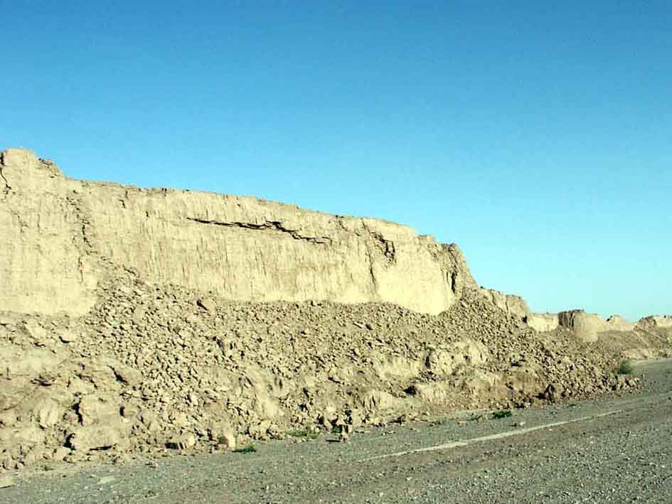 Fig. 38 – Western rampar |
 Fig. 39 – Northern rampart |
 Fig.40 – Zoroastrian temple complex |
 Fig. 41 – Zoroastrian temple complex |
|
No restoration had been undertaken for the Zoroastrian temple, just behind Arg-e-Bam and Khale Dokhtar citadel, 2 Km North of Arg-e-Bam. Before the earthquake, they were severely ruined and the earthquake did not damage them as much as the restored city of Arg-e-Bam. |
 Fig. 42 – The Khale Dokhtar Citadel |
 Fig.43 – Khale Dokhtar Citadel |
 Fig.44 – Khale Dokhtar Citadel |
 Fig. 45 – Ice House |
 Fig. 46 – Kushk Rahim Abad Summer Pavillion |
Three kilometers east of Arg-e-Bam are the Summer Pavilion Kushk Rahim Abad and an old caravanserai. Both were not really damaged by the earthquake. The summer pavilion was already severely ruined before the earthquake and it did not really damage it.
The old caravanserai had been abandoned long ago, and some of its parts had already collapsed before the earthquake. In fact, it damaged this caravanserai very little compared to the average situation in Arg-e-Bam, Bam and the villages further east. The reason seemed simply that it was well built with sound details, compared to the average building quality seen around.
 Fig. 47 – Old Caravanserai, 3 Km East of Arg-e-Bam |
 Fig. 48 – Old Caravanserai, 3 Km East of Arg-e-Bam |
 Fig. 49 – Old Caravanserai, 3 Km East of Arg-e-Bam |
 Fig. 50 – Old Caravanserai, 3 Km East of Arg-e-Bam |
 Fig. 51 – Nartij Village, 7 Km East of Arg-e-Bam |
 Fig. 52 – Nartij Village, 7 Km East of Arg-e-Bam |
The earthen walls composed of materials of different densities resulting from their different phases of construction, repair and reconstruction proved to be more vulnerable to the earthquake vibrations. The successive phases of construction of Arg-e-Bam over the centuries have produced walls of a very different composition.
Every layer was of a different density and cohesion resulting from the different ages. Organic material was used for reinforcement but rotted or was eaten by insects, leaving cavities and friable earth.
The 20th century restoration work in Bam has aggravated the problem. The clay stucco reinforced with straw added before the earthquake appeared to have been consumed by termites.
The changes to the walls of the Arg over the centuries and the recent restorations can be proven to be a major part of the cause of its heavy destruction.
Conclusion
When reading and hearing news reports on the earthquake we are under the impression that tens of thousands of people died in ancient mud buildings. In fact, among the 26,200 who died in the earthquake, about 68 % of people died in modern buildings made of steel, concrete and fired bricks, which were less than thirty years old. Only 32 % of casualties occurred in earthen buildings.
Arg-e-Bam has been an archaeological museum for the last fifty years and at the time of the earthquake (5:36 AM) no one was in the citadel but three employees.
It is also essential to realize that there was hardly a single building, ancient or modern, that did not suffer very severe or total destruction. Most of the steel frame buildings and concrete buildings constructed in the past decades were totally destroyed. None of the buildings was designed to resist a major earthquake.
 Fig. 53 – Bam, Steel frame and fired bricks |
 Fig. 54 - Bam, Steel frame and fired bricks |
 Fig. 55 - Bam, Steel frame and fired bricks |
 Fig. 56 - Bam, Steel frame and fired bricks |
 Fig. 57 - Bam, heap of bent steel and fired bricks |
 Fig. 58 - Bam, Steel frame and fired bricks |
The destruction of the earthen complex of Arg-e-Bam should not be used to condemn unfired earth as a building material. As the UNESCO report stated: “The impact of the earthquake on the built heritage of Bam and its infrastructures demonstrated that it was the quality of construction and engineering of the buildings that was the main cause of damage rather than the construction materials themselves”.
It is therefore fundamental to upgrade the Image of vernacular architecture among local populations to ensure the transmission of adequate traditional skills.
Also, one should remember the images of the ancient structures that did not collapse. They are standing examples that earthen structures can resist major earthquakes even better than some steel frame modern buildings. But still, the Bam earthquake highlighted the need to develop seismic earthen architecture technology.
To guarantee the protection and prevention of damage to earthen heritage, the UNESCO has issued a series of advices:
- Increase understanding of the complete behavior and performance of the earth material, structure and construction in seismic areas
- Document the traditional cultures and architectures where earth is the principle building material, paying special attention to their specific responses and relationships to the needs of the inhabitants and environments
- Document the different types of existing earthen materials and building systems, to understand and develop a glossary for the processes of decay
- Maintain and monitor all types of earthen structures
- Ensure that a full understanding and appreciation of earthen architecture, building materials and structures is integrated into the documentation used by all involved in conservation activities.
- Satprem Maïni, Diagnostic of Damages to Vaulted Structures, Arg-e-Bam and Bam Area, Iran, 2-15 May 2004
- UNESCO, Bam Declaration, 20 April 2004
- ICHO, Bam Citadel, 2004
- ICHO, The Bam Citadel, A Comprehensive Introductory Report, 2004
- CRATerre-EAG, UNESCO Mission to Bam, Iran, 10-20 March 2004
- Randolph Langenbach, Soil Dynamics and the Earthquake Destruction of the Earthen Architecture of the Arg-e-Bam, 2004.
- http://whc.unesco.org/
Sources: